Earthquake
M4.2 Earthquake near Pahiatua New Zealand
- Reported
- 2026-10-12 06:52 UTC(9 hours ago)
- Last update
- 2026-10-12 14:26 UTC(2 hours ago)
- Nearby cameras
- 1(nearest 37 km)
- Data sources
- USGS
What’s happening
Earthquake reported at 25 km SSE of Pahiatua, New Zealand. 1 public live camera in the TubeTraveler directory sits within 37 km of it.
A magnitude 4.2 earthquake was recorded near 25 km SSE of Pahiatua, New Zealand on 2026-10-12 at 06:52 UTC. Reported focal depth is approximately 32 km. All figures above come directly from the agencies credited at the bottom of this page and can change as they publish updates.
- Magnitude
- M4.2
- Depth
- 32 km
Where it is
The reported location is 25 km SSE of Pahiatua, New Zealand. Coordinates are -40.677, 175.900 — the single point agencies use to summarise the event, not the boundary of the area involved. The event sits within New Zealand.
Nearby Live Cameras for M4.2 Earthquake near Pahiatua New Zealand
37 km from the reported event location · matched by location and camera category
- Primary
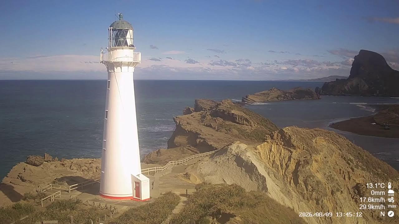
🇳🇿 Castlepoint Lighthouse, New Zealand
- Distance
- 37 km away
- Camera type
- 🗼 Landmark
- Local time
- 5:03 AM
- Weather
- 🌤️ Mostly clear, 15°C
- Sunset
- 06:32 UTC
- Live status
- Online at last check
- Last checked
- 13 hours ago
Matched by location and camera category — Castlepoint Lighthouse is about 37 km from the reported event location.
Nearby cameras may show general local conditions but may not show the event itself, damage, or emergency response activity.
Watch on the original YouTube channel (Castlepoint Lighthouse) →Why these cameras were matched
TubeTraveler searched its public camera directory within 150 km of the reported location for this event type and found 1 camera with usable coordinates. The closest of them, Castlepoint Lighthouse in Castlepoint Lighthouse, is about 37 km away. Ranking also accounts for camera type — landmark views score higher for earthquake. Distance is measured from the coordinates the reporting agency published, so it describes proximity rather than line of sight.
What the cameras may show
Depending on the camera you open, you may be able to see conditions around a well-known landmark. What is visible changes with daylight, weather and where each camera happens to point.
What the cameras cannot confirm
A public live camera cannot confirm the scale of any damage, injuries, casualties or the condition of anyone involved, whether an official evacuation or alert is in force, anything happening outside the camera’s field of view, and the intensity of shaking at any particular address. There is also no guarantee that the event itself is visible from any of these cameras — a stream may be pointing elsewhere, be delayed, or be showing an ordinary day in a place that is otherwise affected.
Event location and nearby cameras
The circle marks the location reported by the source agency; squares mark public live cameras.
Update timeline
- 2026-10-12 14:30 UTC — Event first detected via USGS
- 2026-10-12 14:30 UTC — First live camera matched (1)
How this record was built
This record is built from data published by USGS Earthquake Hazards Program. Last data update: 2026-10-12 at 14:26 UTC. Cameras attached here are located in Castlepoint Lighthouse (New Zealand).
Information on this page can change as agencies publish updates. Read the methodology · Report an error on this page
Official sources
USGS
Source last updated 2026-10-12 14:26 UTC
Earthquake data courtesy of the U.S. Geological Survey (USGS).